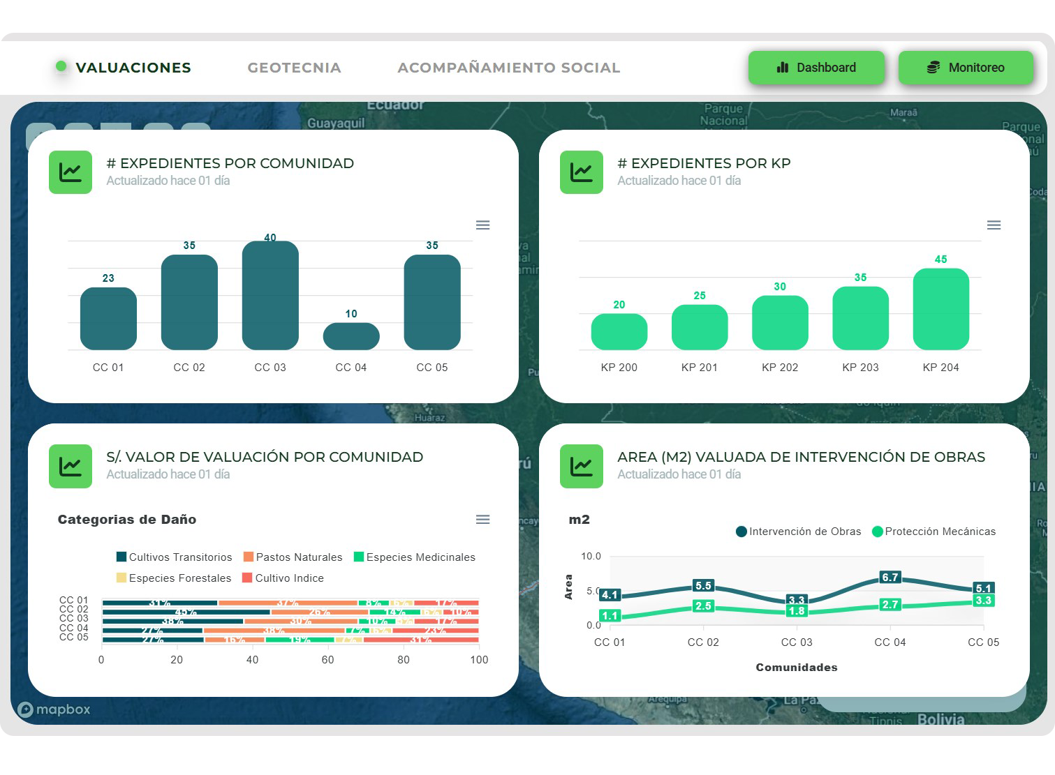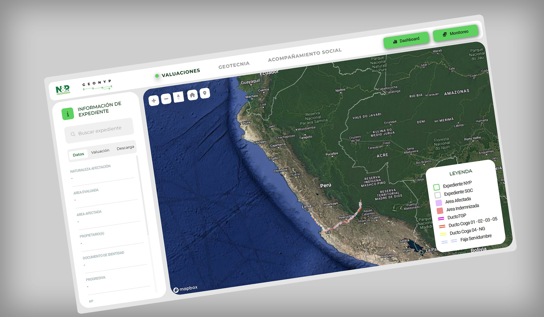
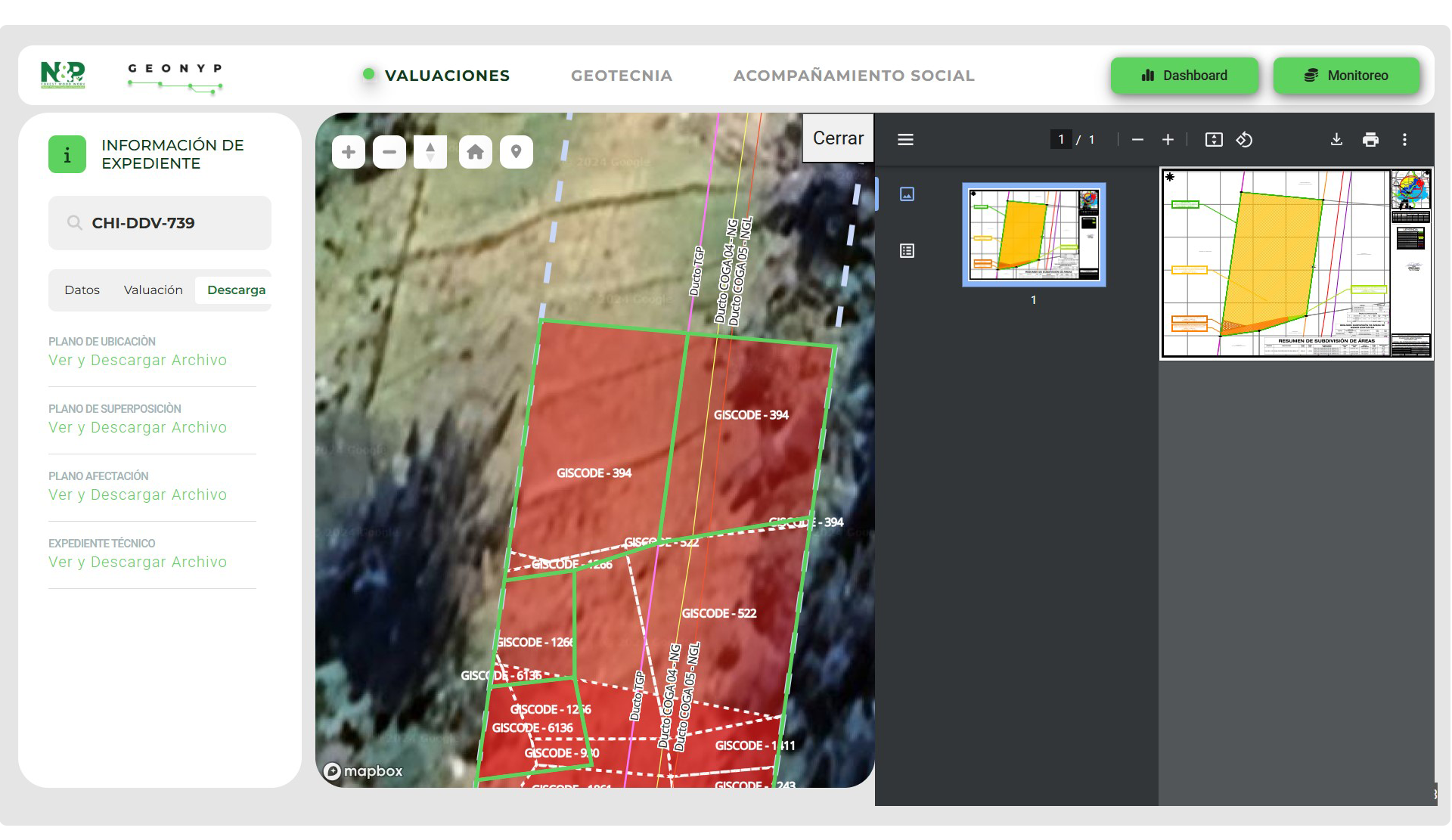
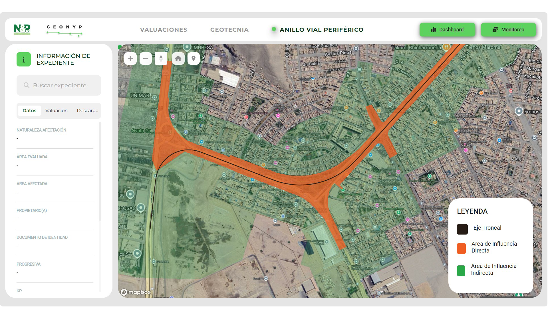
GEON&P - To interactively visualize and analyze geospatial data
Providing detailed and accurate real-time reports.
ADVANTAGES
- Simplifies the visualization and understanding of georeferenced project data.
- Accessible from any device.
- Enables collaboration between different operational areas of projects and facilitates the exchange of georeferenced information.
- Allows daily monitoring and management of team activities, generating automated progress reports to support decision-making.
- A robust tool offering different levels of access and security. Documents remain secure, and access can be easily controlled by the client.
- Additionally, GEON&P offers modular adaptability to automate the management and utilization of large datasets. This flexibility ensures a unique configuration for each client, enabling the creation of specialized reports with relevant information and customized dashboards tailored to the client's specific needs.