Photogrammetry and management of the LiDAR System
Support for georeferenced aerial images with photogrammetric precision
What is photogrammetry?
Photogrammetry is the process of measuring with images. These can be images captured with a wide range of devices, such as drones, airplanes, and handheld cameras, to name a few. These images are used to generate precise and accurate 2D and 3D models.
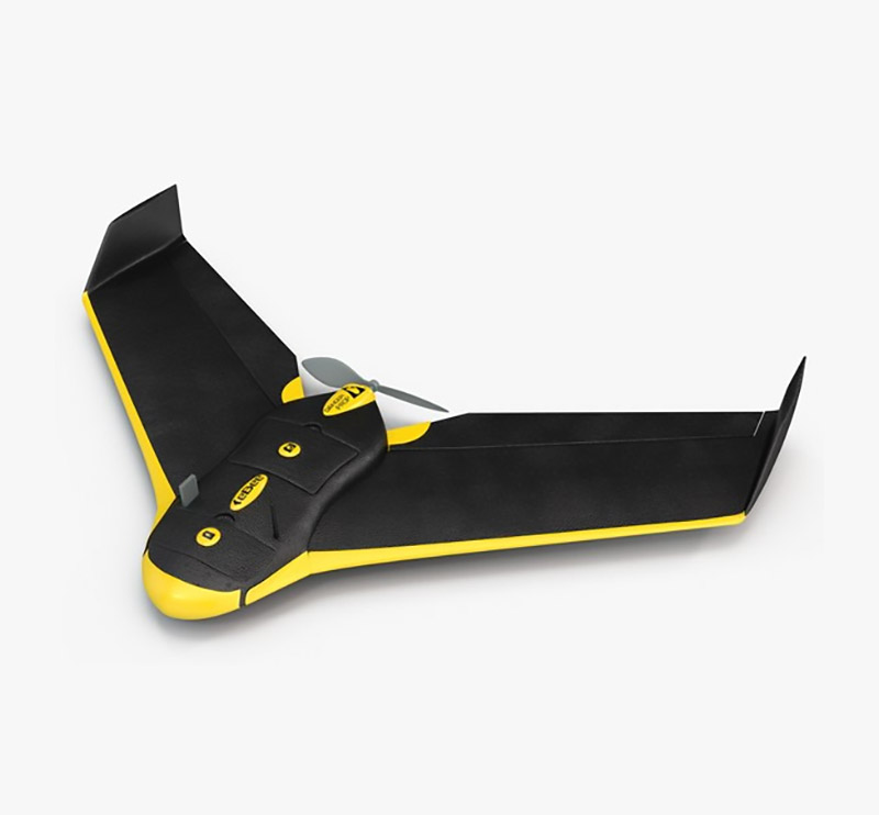
EBEE PLUS RTK
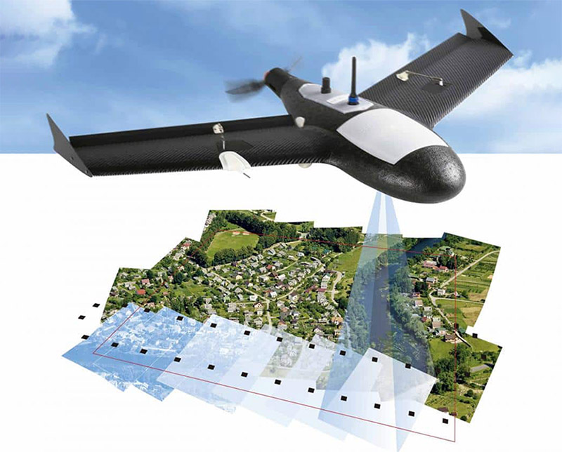
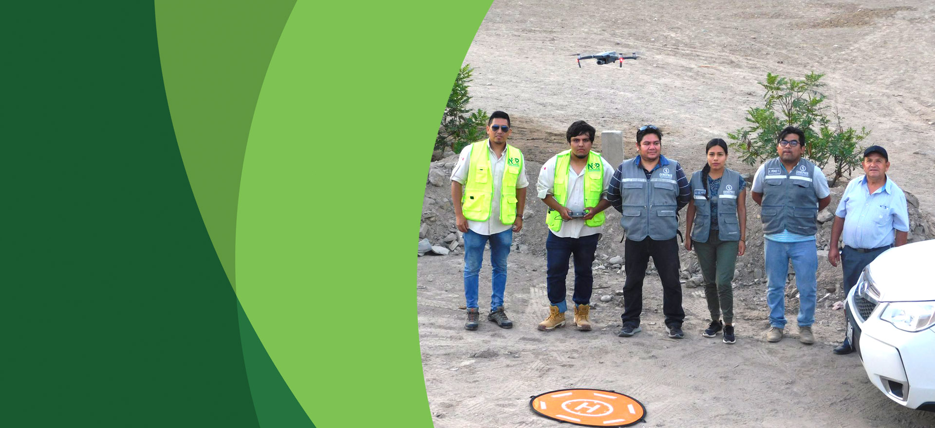
OBTAINING AERIAL PHOTOGRAPHS
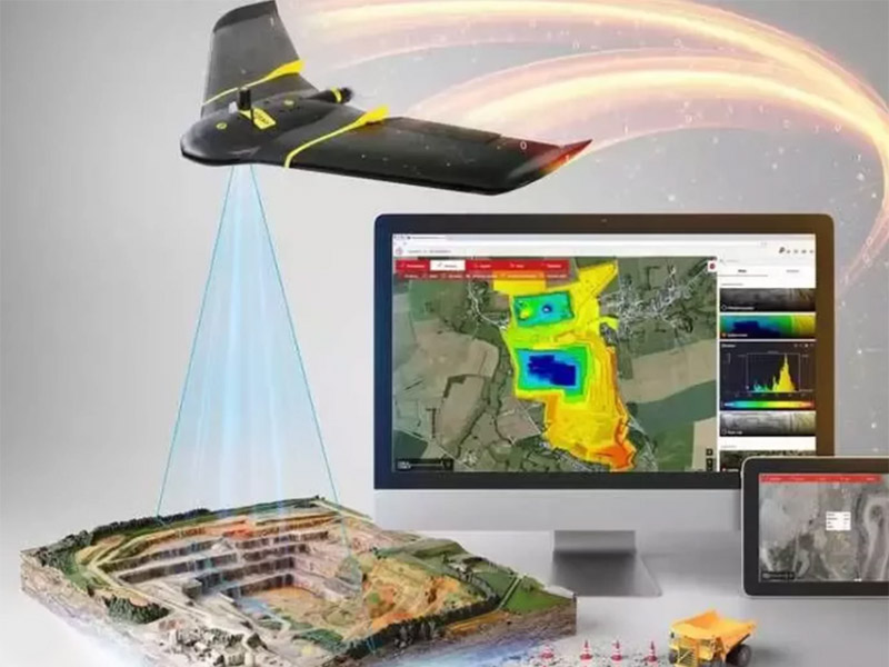
INFORMATION PROCESSING
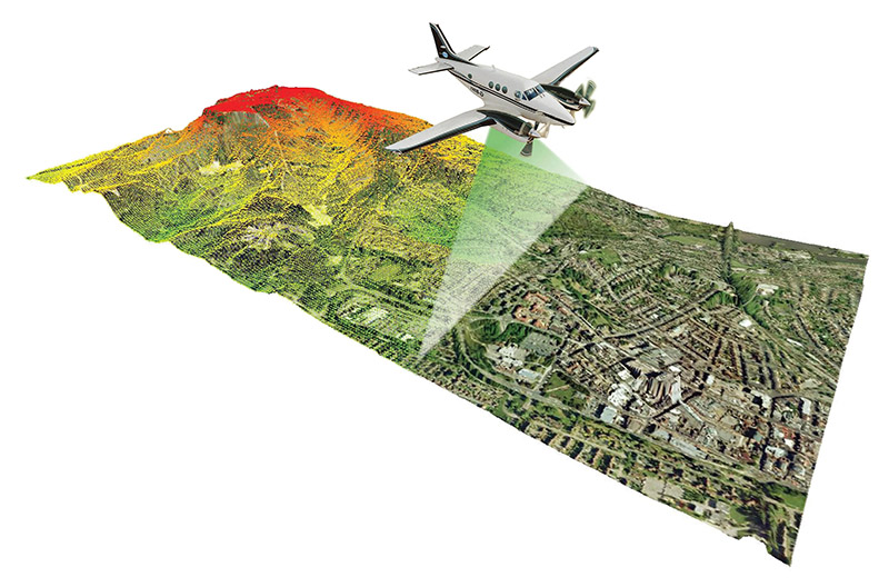
What is a LiDAR sensor?
A LiDAR Sensor, from the acronym LiDAR (in English, Light Detection and Ranging or Laser Imaging Detection and Ranging) is a system for measuring and detecting objects through lasers. In other words: a scanning and remote sensing technology that uses the emission of a laser pulse to calculate surfaces and map spaces in three dimensions (3D).
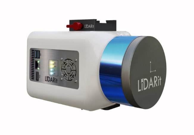
LIDAR SENSOR "LIDAR iT EXPLORER R"
COLLECTION OF INFORMATION IN THE FIELD
INFORMATION PROCESSING IN CABINET
In what areas are they applicable?
- 1. Disaster Risk Management “DRM”
- A. Risk Prevention Plan.
- B. Riverside Defense Plan.
- C. Urban Planning.
- D. Housing Relocation.
- 2. Cadastre
- A. Urban.
- B. Rural.
- 3. Legal Physical Sanitation “SFL”
- A. Urban.
- B. Rural.
- C. Eriazo.
- 4. Property appraisal
- A. Urban.
- B. Rural.
- 5. Other activities
- A. Topography.
- B. Forest Inventories.
- C. Planning of Forest Projects.
- D. Design of new communication routes.
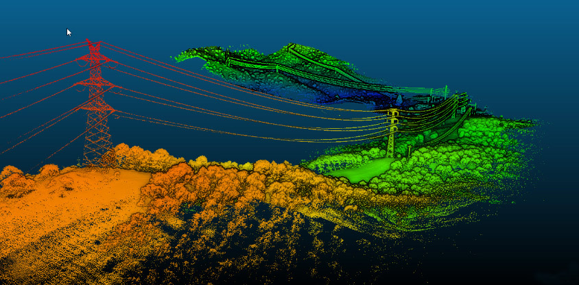
- E. Design of ROW (Right of Way), for construction works, gas pipelines, power lines, etc.
- F. Geotechnics.
- G. Archaeology.
- H. Asset Inspection.

Our Work Phases
Planning
Phase 1
Coordination with the user client to define the work area
Management of access permissions (if applicable)
Written confirmation of the details of the desired deliverables.
Fieldworks
Phase 2
On site, carry out the corresponding coordination if applicable.
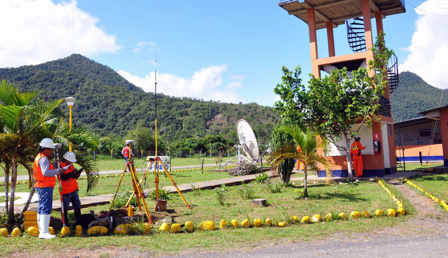
Placement or identification of "C" order geodetic points and support control points (marks in the field) to adjust and overlap the photos.
Photogrammetric (Drone) and topographic survey of control points (RTK Methodology).
Measurements with the management of the LiDAR System if required.
Office Work
Phase 3
Point cloud.
DTM (Digital Terrain Made).
DSM (Digital Surface Model).
Level Curves.
Orthomosaic (Orthophoto).
Deliverables
Phase 4
Orthomosaic (Orthophoto).
Orthomosaic georeferenced in Google Earth.
Planes with contour lines between 1m and 2m.
3D modeling
Videos in HD, Full HD and 4K.
DELIVERABLES
- INITIAL PRODUCT
- Point cloud.
- DTM (Digital Terrain Model).
- DSM (Digital Surface Model).
- Level Curves.
- Videos in HD, Full HD and 4K.
- FINAL PRODUCT
- Orthomosaic (Orthophoto).
- Orthomosaic georeferenced in Google Earth.
- Planes with contour lines between 1m and 0.2m.
- 3D modeling.
- Videos in HD, Full HD and 4K.
Gallery
Work phases
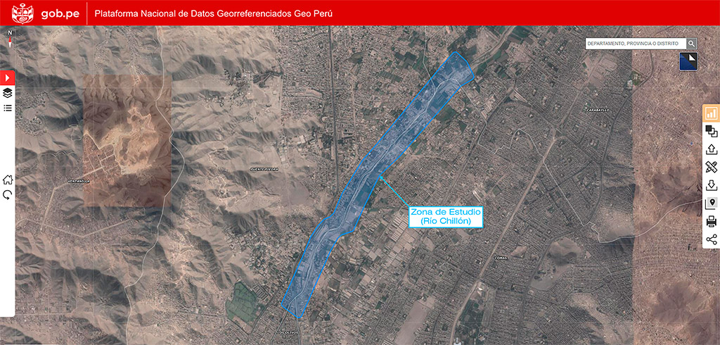
FIELD OF STUDY
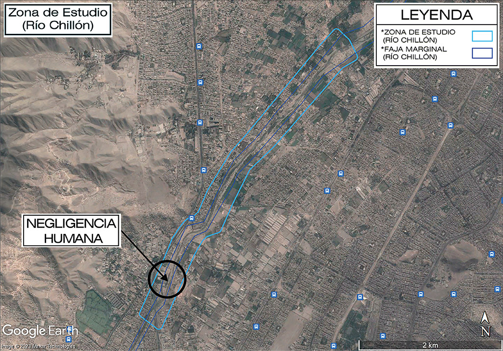
FIELD OF THE PROBLEM
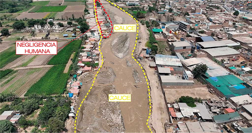
PROBLEM
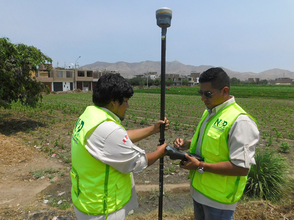
FIELD WORK
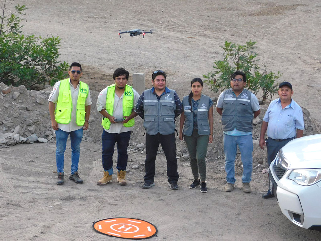
WORKING IN SYNERGY
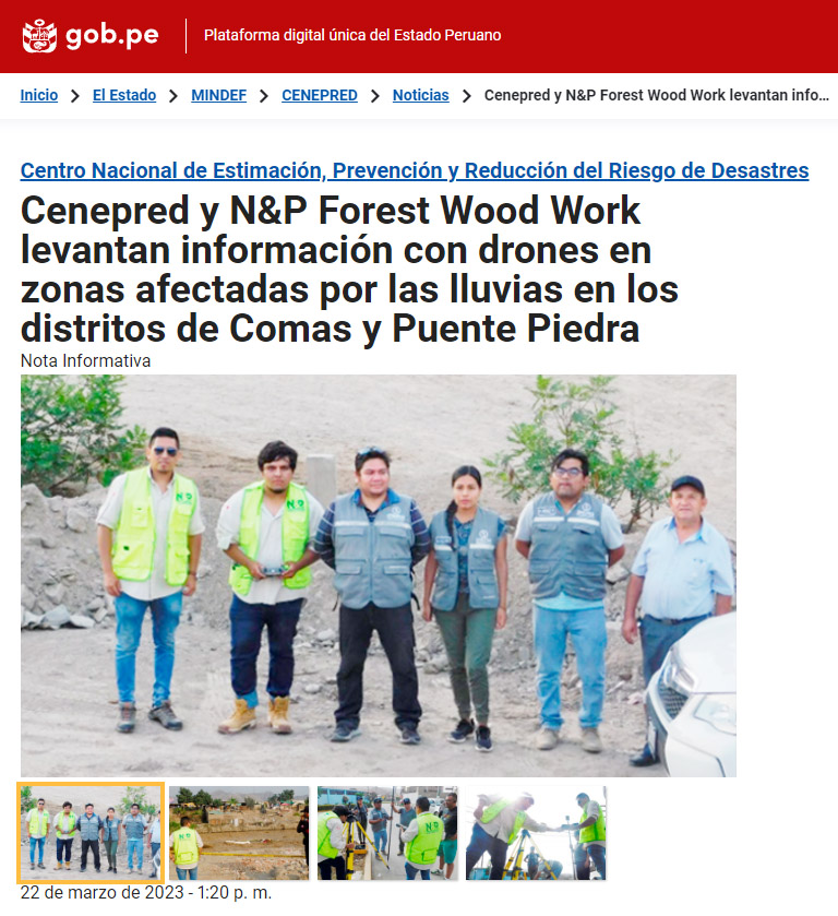
NEWS
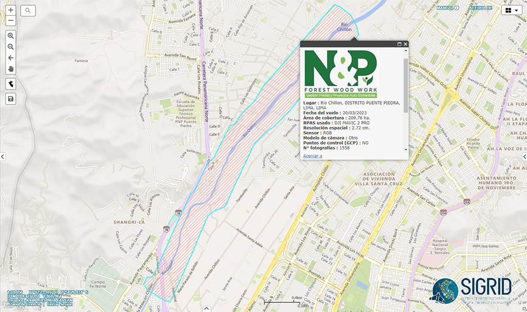
PRESENCE IN GEOPORTAL SIGRID
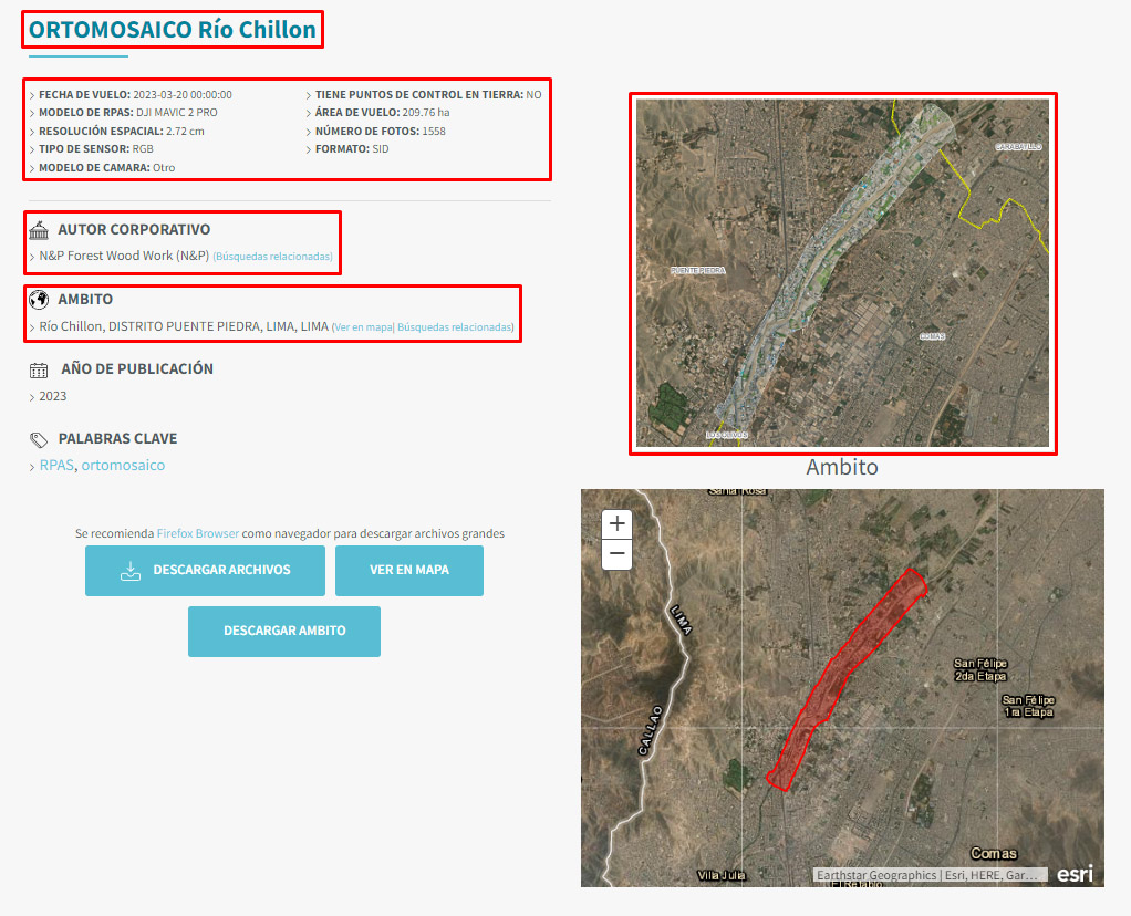
ORTHOMOSAIC - ORTHOPHOTO
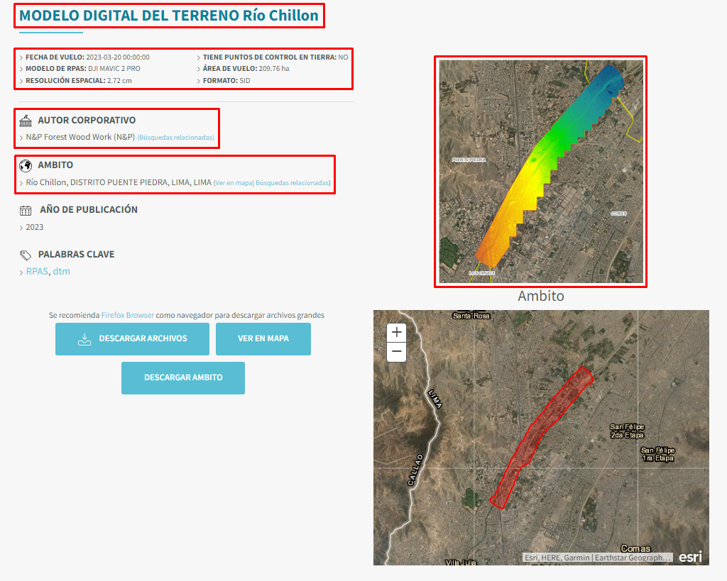
DIGITAL TERRAIN MODEL - DTM
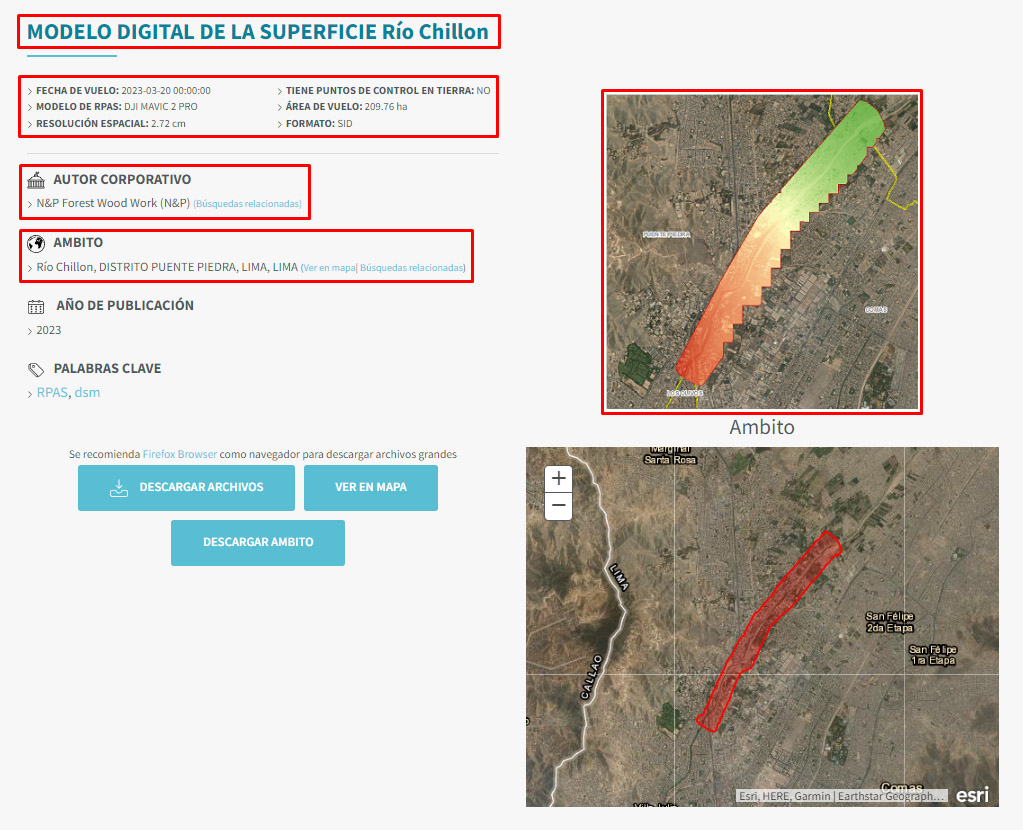
DIGITAL SURFACE MODEL - DSM
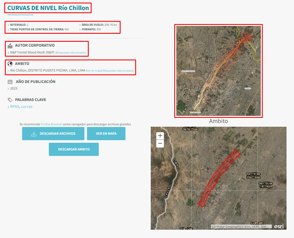
LEVEL CURVES
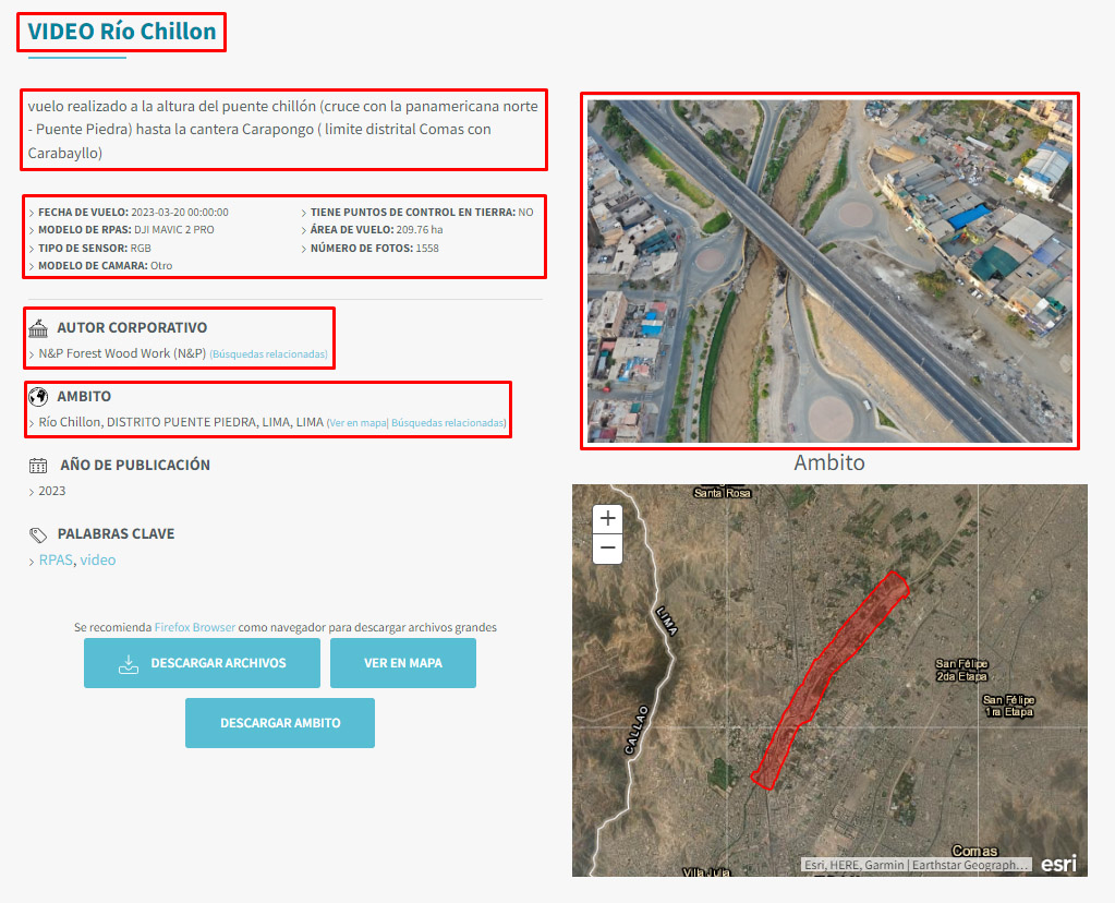
FULL HD VIDEO