News
N&P Stands Out at AGROFEST 2025 with Innovative Solutions for the Agricultural Sector
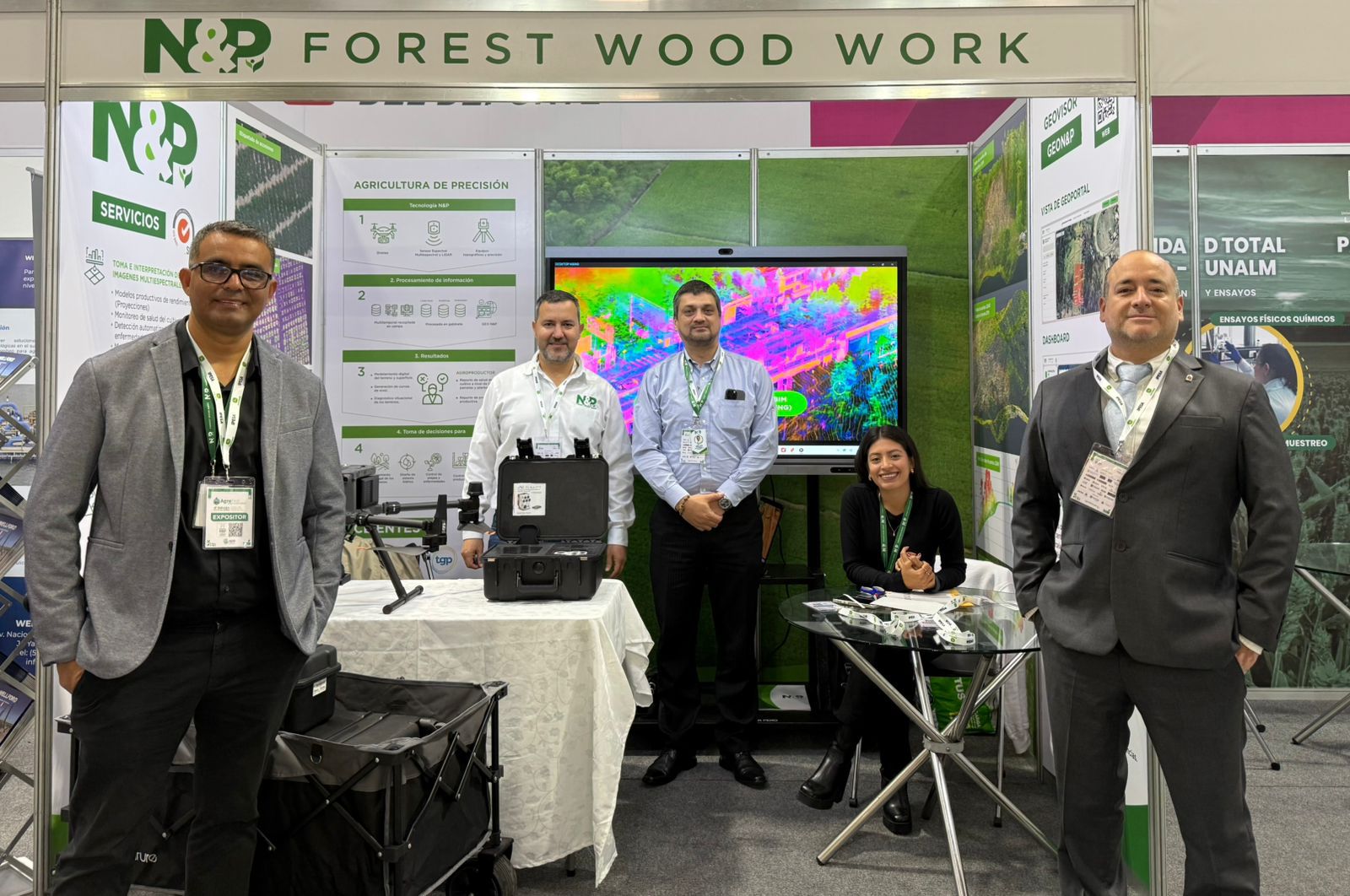
From June 11 to 14, 2025, N&P participated successfully in AGROFEST, one of the most important trade fairs in the agri-industrial sector, where companies, producers, and professionals from the agricultural field gathered. During the event, N&P showcased its portfolio of specialized services in Agricultural Management, standing out for its focus on innovation, sustainability, and the use of advanced technologies to optimize agricultural productivity.
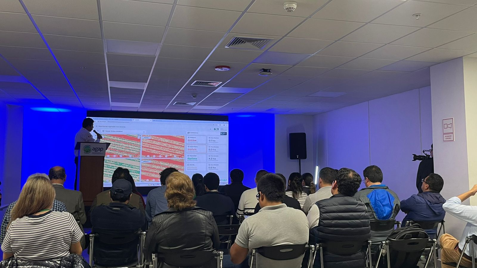
One of the event’s highlights was the talk on SMART FARMING, organized by N&P’s technical team. The presentation attracted a large audience interested in learning how tools such as photogrammetry, topography, and georeferencing are transforming the way crops are managed, enabling more efficient, data-driven decision-making.
In addition, the fair provided a valuable space for networking with key players in the agricultural sector, generating opportunities for collaboration, strategic partnerships, and new projects. Representatives from various companies, agricultural cooperatives, and public entities expressed strong interest in N&P’s solutions, recognizing their unique value in the market.
N&P’s participation in AGROFEST reaffirms its commitment to the development of the agricultural sector, embracing technology as a key tool for more efficient and sustainable agricultural management.
N&P Shines at SITDRONE Expo with Photogrammetry and LiDAR Services
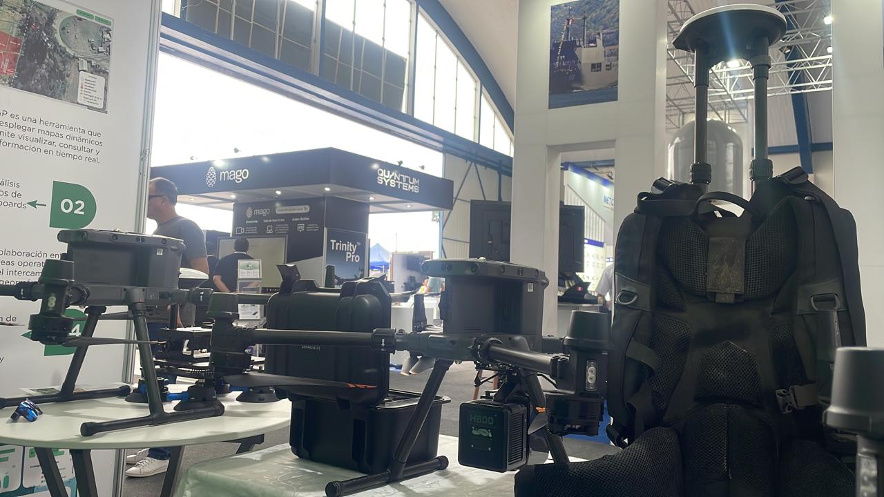
At the recent SITDRONE Expo, held from November 21 to 24 at the Las Palmas Air Base, one of the most significant events in the drone technology and digitalization sectors, N&P established itself as a leader in innovation and quality by showcasing its advanced photogrammetry services using LiDAR sensors. This event, which brought together key players in the industry, provided the company with an opportunity to demonstrate its capabilities in leveraging cutting-edge technology for geospatial data capture—a crucial tool in industries such as oil and gas, energy, real estate, forestry, transportation, and mining.
Technological Innovation Driving Photogrammetry
LiDAR-based photogrammetry is a technique that uses lasers to measure distances and generate highly accurate 3D models of terrain or structures. During its participation at SITDRONE, N&P presented its data capture solutions using drones equipped with LiDAR sensors, which enable the creation of detailed topographic models, even in complex or hard-to-reach terrains.
Thanks to this technology, the collected data is significantly more accurate and detailed compared to traditional methods. Additionally, LiDAR can penetrate vegetation, making it particularly effective in data collection within forested or densely vegetated areas—an area where other measurement techniques face significant challenges.
A Participation That Reinforces Commitment to Innovation
N&P’s presence at the SITDRONE Expo did not go unnoticed. The company’s value proposition underscored the importance of drone technology in driving digitalization and improving processes across various industries.
Through its participation, N&P showcased its commitment to innovation and its relentless pursuit of solutions that enhance data collection and decision-making for complex projects. Undoubtedly, its contributions to the event reaffirm its position as a key player in drone technology and advanced geolocation solutions.

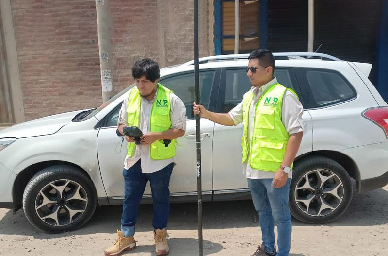
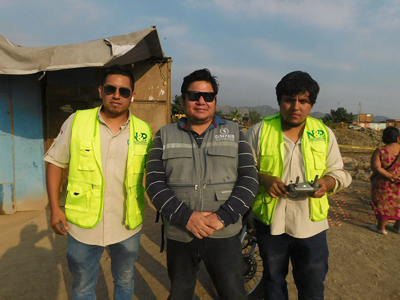
Cenepred and N&P Forest Wood Work collect information with drones in areas affected by the rains in the districts of Comas and Puente Piedra
The National Center for Disaster Risk Estimation, Prevention and Reduction (CENEPRED) and the private sector work in coordination for the benefit of affected local governments during this rainy season.
The National Center, in collaboration with the company N&P Forest Wood Work, collected detailed information with the RPAS Remotely Piloted Aircraft System (Drones) to generate mapping of the area exposed to danger from flooding of the Chillón River, in the Malecón Chillón sectors. and Avenida Malecón in the Comas district and the Pardo Novoa, El Platanal and Villa Cruz housing associations in the Puente Piedra district.
During the activity, information was generated for decision-making within the framework of Disaster Risk Management (DRM) associated with dangers such as floods and landslides; thus strengthening public and private collaboration to create value from cartographic data.
The products generated, it should be noted, will be made freely available to the local governments of Puente Piedra and Comas, as well as to civil society, through the platform of the Information System for Disaster Risk Management (SIGRID).
It should be noted that SIGRID is a free access geospatial web platform, designed to consult, share, analyze and monitor information related to dangers, vulnerabilities and risks caused by natural events.
Reference: