LiDAR APPLICATIONS
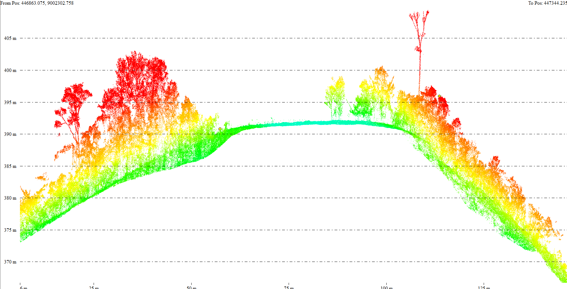
1. Hydrocarbons
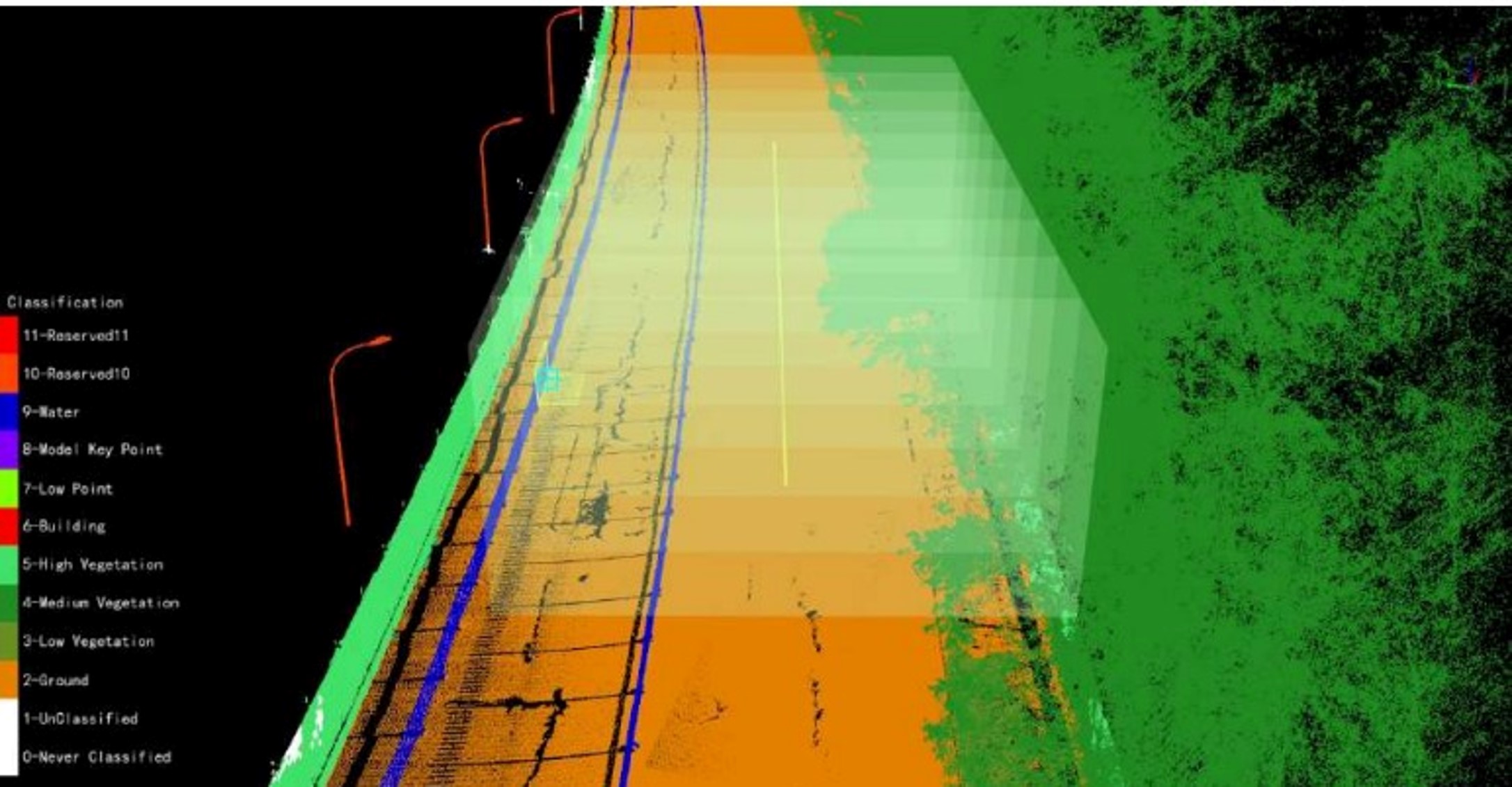
Longitudinal Profiles – Primary Geology
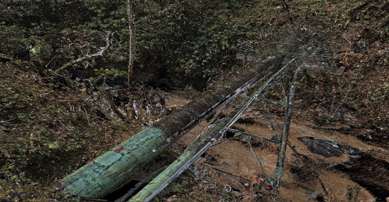
Pipeline and Bridge Coating Scanning – SLAM 3D LiDAR
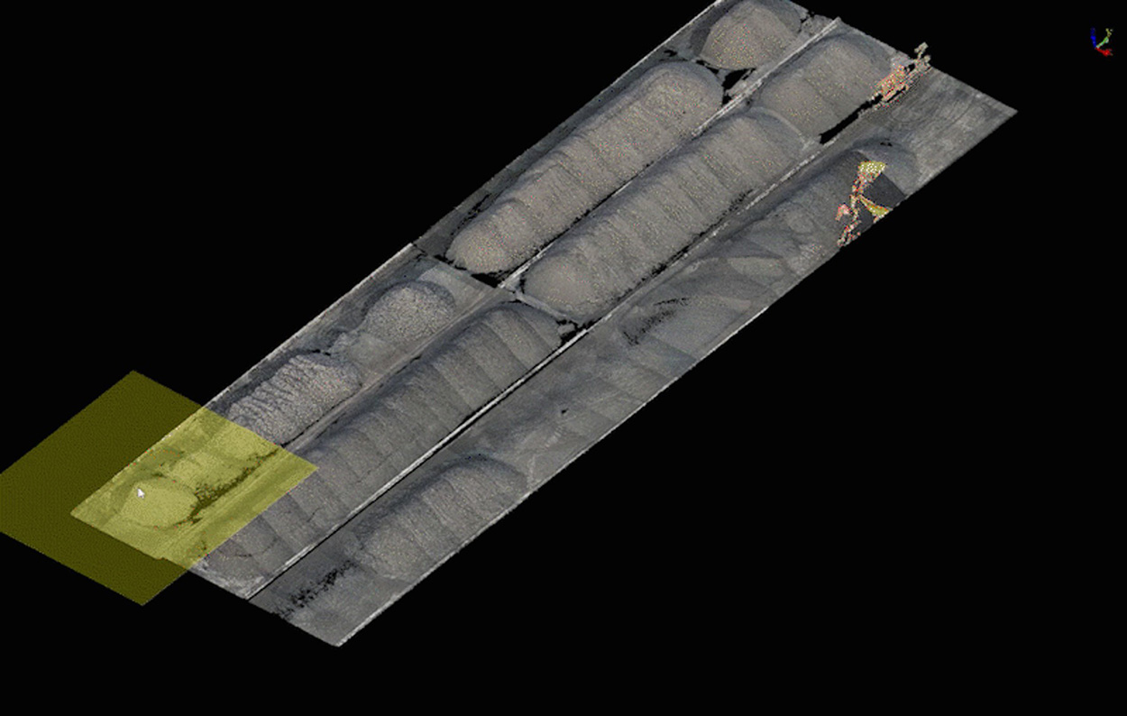
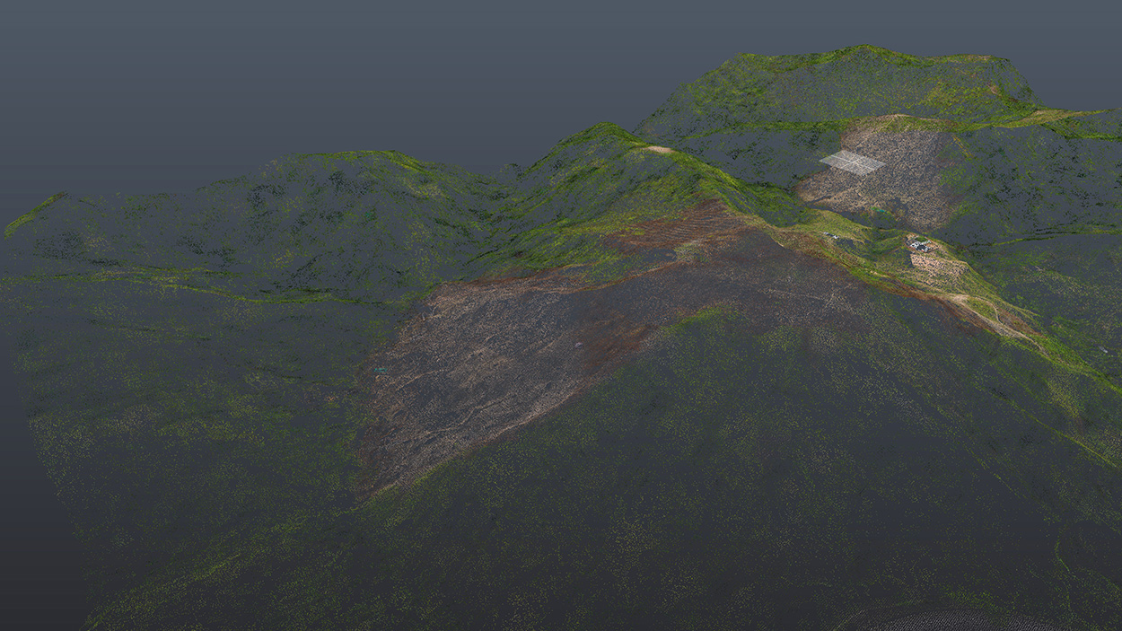
2. Mining
Monitoring of Deposits and Waste Dumps
Stability control of slopes and material piles to prevent landslides.

Volume Calculation of Extracted Material
Accurate estimation of removed material and inventory analysis in deposits.

Mining Exploration and Planning
High-precision mapping of surface topography to plan access to underground or open-pit mines.

Environmental Impact Monitoring
Tracking post-mining land recovery through temporal terrain comparisons.
Optimization of Internal Transport in Open-Pit Mines
Efficient design of routes and roads for material transportation.

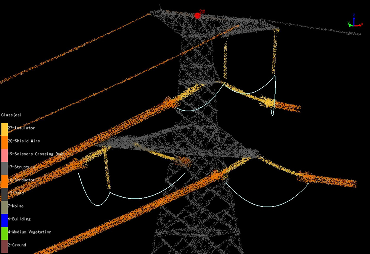
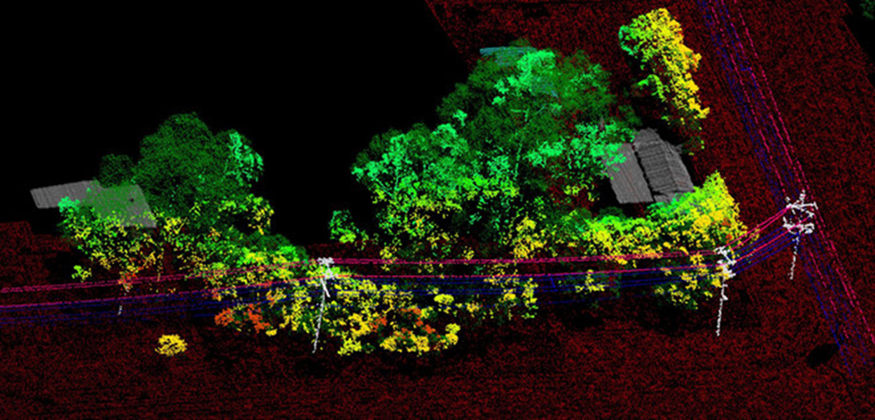
3. Energy (Transmission Lines)
Aerial Inspection of Transmission Lines
Detection of structural damage and corrosion in towers and cables. Identification of vegetation that poses risks to lines to ensure compliance with safety regulations.
Easement and Right-of-Way Monitoring
Tracking land use within transmission corridors.
New Line Planning
Terrain modeling to define optimal routes and avoid obstacles.

DMS
Minimum Safety Distance
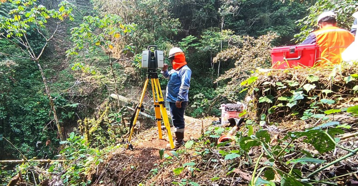
4. Land Surveying
Surface Topographic Surveying
Measurement of land, lots, or urban and rural parcels of interest.

Urban Planning and Land Use Management
Creation of 3D city models for urban growth simulation.
Legal and Physical Land Regularization
Planning and identification of required areas.

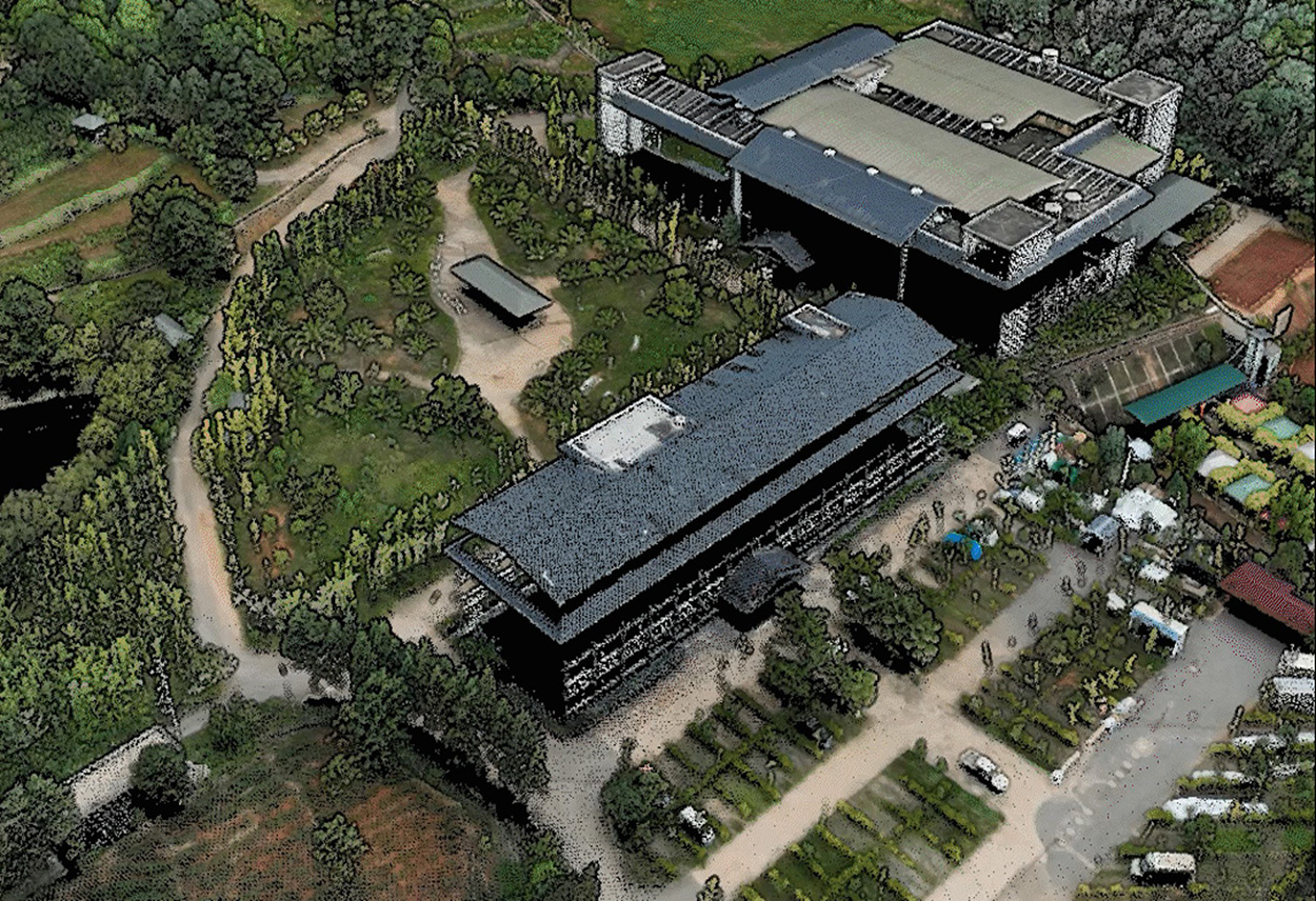
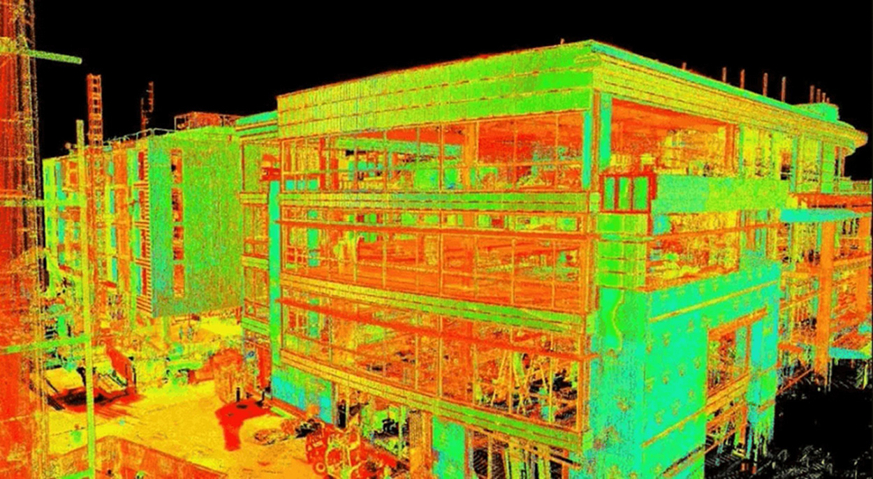
Modeling for BIM (Building Information Modeling) Projects
Integration of LiDAR data into design platforms for civil works.
5. Forestry
Wildfire Management
Creation of fire risk maps and monitoring of vegetation changes.

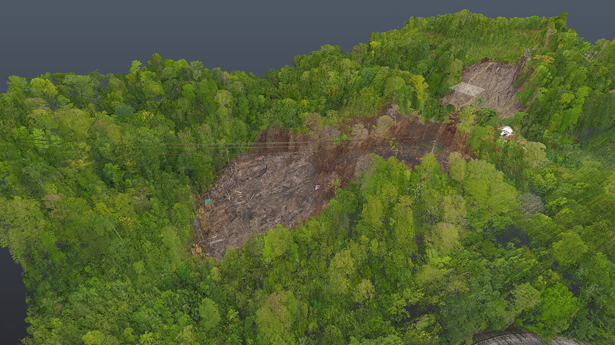
Deforestation, Logging, and Illegal Plantation Control
Detection of forest cover changes.

Terrain Definition with and without Vegetation Cover
Real visualization of surface relief.
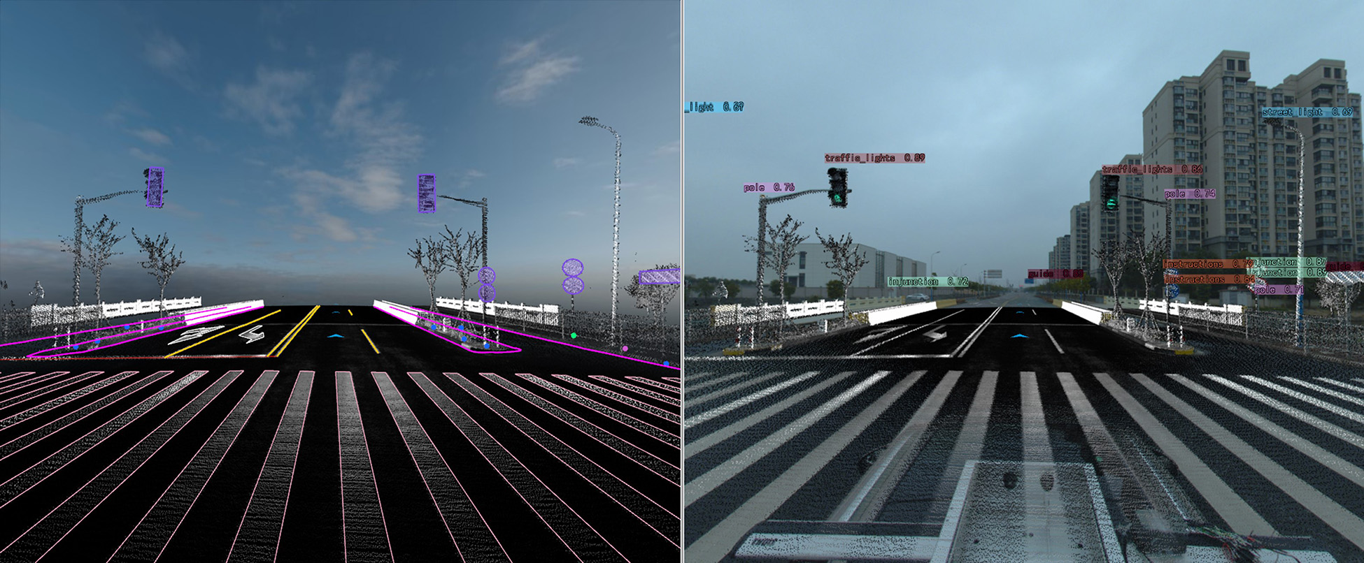
6. Roadways
Road Inspection and Monitoring
Assessment of deformations, subsidence, and erosion in pavement and slopes.

Tunnel Infrastructure Modeling
.jpg)
Roadway Inventories